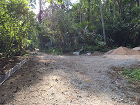
trail in Petaling Jaya. Many months later I keep on improving, climbing even higher and more difficult mountains until finally late last year I signed up for one of the toughest climb I have ever attempted in my life. Climbing the highest mountain in peninsular Malaysia, gunung Tahan.
Climbing the highest mountain on the land naturally is no easy feat. I trained for months in advance, climbing several mountains including Gunung Telapak Buruk and
. I must say I’m glad for all that training because it gave me ample preparation and experience to do Tahan.
(HACAM) group. Led by the founder, MK Rahman in conjunction with Core Adventure professional guide service. The total cost was only RM260 not including travelling arrangement from KL to Merapoh in Pahang. The price is about right for such — expedition 4 days 3 nights, permit and food. Anything more than 300 ringgit is a ripoff (unless they’re serving gourmet dinner). When the first invites were sent out to everybody, there were no less than 70 goings recorded on Facebook. However as always, the real serious participants settled down at exactly 12 people including the 2 guides. We discussed car pool arrangement beforehand and in the end we were piled up in 2 cars and one pickup truck.
The agreed meeting time was 8:30 PM at Gombak LRT station but since not everybody bothered to be on time we didn’t leave for Merapoh until 10:00 PM. I knew this was gonna happen and how it will affect my hike the next day but what can I do but grumble loudly from the inside. Traffic was heavy but still moving because of the school holiday and we stopped for a late supper in Raub. I was the fortunate one to hitch a ride in a Kancil so you can imagine the ultimate level of comfort and luxury that I experienced during the 4 hours drive. We reached the Sungai Relau National Park entrance around 4:00 AM. We tried to sleep on the benches inside the park but the guards only let us sleep outside the gates under some huts. Which is perfectly fine by me. I quickly take out my sleeping bag and got an hour or two of shut eye before daylight approaches.
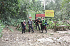
First thing first, breakfast of course. The distance from the park to the main road is 7 kilometers so that’s how far we had to drive to get breakfast and other supplies from the nearest shop/restaurant. I had some nasi berlauk but didn’t pack any lunch because none of the menu on offering in the stall entices me (what can I say? I’m picky like that). We begin distributing our rations so that everybody carries an equal part. After that we began assembling in front of the park ranger’s office. It’s that dreaded time where we declare most of the things that we carry into the park. Plastic bags, butane gas canisters, clothes, batteries and stuff. It took a while before everybody is checked and ready. Next we listened to some briefing from the park ranger about the do’s and dont’s in the park. I was mighty relieved to here that If I’m injured I’ll probably have to drag myself out back to the entrance and no rescue helicopter will be sent to bring me out. The last time a helicopter did came by was to ferry out a dead body.

After the inspection and list-taking is done, we finally took the 4WD to Kem Juram, the starting point of our hike to Gunung Tahan. There’s a row of dormitories there at Kem Juram but they’ve been unoccupied for some time now. The only thing of interest there is the mahseer fish nursery at the adjacent river by the camp. Without further ado, we started our hike from the beggining of the hiking trail. We crossed about 5 streams before reaching the first pit stop at Kuala Luis some 5 kilometers away. We had lunch there before resuming our journey to our first camp site at Kem Kor which is 750 meters above sea level. The first day we hiked not more than 8 kilometers and since everybody walked pretty fast, we reached the camp site before 4:00 PM. We purposely chose a campsite next to water because it’ll be convenient for us to get water for drinking, cooking and washing and stuff. We set up camp — tents and stuff and our two guides cum cook prepares dinner for us that night and for the rest of our trip. We had steamed
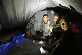
siakap (barramundi) with rice for dinner. I normally would not eat fish if I had other choice but since we’re camping and my wife was not the cook I can’t be really picky. The fish surprisingly was quite good (except for the pesky bones of course). After dinner we sat around a campfire and had an ice-breaking session to get to know each other better. We introduced ourselves and shared stories until late at night. We slept in a 3-men tent. As a rule of thumb, a 3-men tent would be comfortable for 2 person. 3 persons in a 3-men would be rather crowded with hardly any room to move. But since the tents are provided by the organizer we’ll have to make do. Besides, a bigger tent would mean a heavier backpack. We took turn to carry the tent, rain cover and the steel frame throughout the trip.

Temperature at Kem Kor was quite cold in the evening and also morning, cold enough to make you put on your jacket. There’s hardly any mosquitoes at the camp or on the mountains in general you’ll have to tolerate the pesky gnats. As cold as the temperature was at the campsite, I didn’t miss my morning bath even once. While some of my fellow hikers didn’t bother to bath, I braved the icy cold water to clean up myself and can’t imagine myself walking around smelly and stuff. After breakfast, we resumed of hike. The second day is one of the more gruelling part of the hike. We covered more kilometers compared to the first day, about double the distance. We crossed the stream next to our campsite and it’s all uphill from there. The monsoon season was definitely over so it was a hot and dry hike all the way. There’s little or no water point on the way to the peak so we’ll have to rely on the water supply that we carried ourselves. Actually there is one water point near Kem Kubang but we’ll have to hike for another 30 minutes to get there so nobody except for two people bothered to get water from there. Besides, we were told that there will be running water near Kem Botak, the last campsite before the peak.

Before Kem Botak, there’s Kem Bonsai. The hike to Bonsai was exhausting with 80° to 90° vertical climb at some parts. The hot scorching sun didn’t help our cause at all. Despite all that, we soldiered on and reached Kem Bonsai around 2:00 PM. The final hike from Kem Bonsai to Kem Botak was even more trying. After we left the cooling shade of the trees, there’s nothing but rocks during the final push to Kem Botak. The sun was shining directly at us and we have used up much of our energy for the day so it was a hard and slow ascend to the last camp site. Everybody did made it and we set up camp at around 5:00 PM. To our dismay, there’s no running water as advertised. What we did found was a couple of seepage water pool by the hill side which was filled with insects, tadpoles and stuff. I suppose water must have used to run there but has since dried up because of the dry weather. Under normal circumstances we wouldn’t dream of using that kind of water (what’s with rats running around the place and all) but we were kind of desperate. Either that or dehydration. So we used the water anyway for drinking and cooking. I get to borrow a membrane water filter from uncle Chuah which did made make my water safe for consumption but still the filtered water tasted and smelled funny. Water or lack of it is part of the adventure during hiking and camping I guess. I was told some mountain trails don’t even have any water points at all and people had to carry their own water throughout their 3–4 days journey. So drinking stinking, foul-smelling water is part of the experience so to speak.

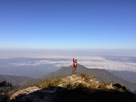
Water issues aside, Kem Botak was definitely beautiful and peaceful. Temperature dropped to a cool 15°C in the evening. We get to catch a glorious sunset from the foot of the hill. And at night we get to watch a thousand stars in the sky. As always I retired early that night. Some people prefer to stay up and chit-chat till late. I just wanna rest and wake up fresh for tomorrow. A few of us planned to wake up early for a morning hike to the peak the next morning. I wasn’t so keen of waking up at 5:30 in the morning so I didn’t plan on joining them at first. But when everybody in my tent did woke up noisily at 5:30, I thought what the heck might as well tag along. It’s not often you get to see sunrise from the tallest peak on the land. Maybe once in a lifetime if I don’t ever return there again. The morning was naturally shivering cold but we braved the elements to begin the final push to the peak. From Kem Bonsai it was all rock all the way. Kinda like Bukit Tabur but twice the length. I was dressed warm for the occasion but as with any other hike, I got sweating in halfway through the hike so it wasn’t so cold after some time.

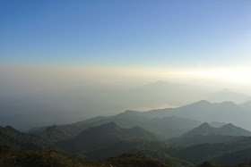
After huffing and puffing our way for an hour or so we finally reached the peak just before sunrise. Just seeing the infamous Gunung Tahan signboard and the majestic view of the surrounding made all our pain and suffering worthwhile. We prayed Subuh at the top of the mountain and then had coffee made from the seepage pool (no filter). It was probably the best damn coffee that I have ever tasted. We hanged around for another hour at the peak, took dozens of pictures while watching the sun rise from the east. I’ve seen one or two mountain-top sunrises before but nothing is as breathtaking as this one on top of Tahan. I tried to capture a timelapse video of the sunrise but somehow my iphone failed to focus on the horizon using the Hyperlapse app so it was mostly a blurry 20 minutes video. Should have adjusted it better. I did managed to make a call to my loved ones from the peak. Yes there’s actually good phone signal on top of the mountain but only for Celcom (Tunetalk) and Maxis. In fact there’s about half a dozen spots along the hike that we found places with good mobile phone signal.

For breakfast that morning, I had a pack of Brahim’s delicious lamb briyani rice. It’s amazing how they could pack such a delicious meals that would last for months. The wonders of modern technology (or preservatives). After the final ascend, it’s time to go down again. I know that this is going to be just as hard as the day before. Partly because there’s not enough water to drink. Yeah I did filter a bottle of water out of those stinking water but I was not so thrilled of gulping down that. The last few kilometers before Kem Kubang was the hardest. The sun was so hot and we were so dehydrated, even the stinking water was going out fast. When we finally reached Kem Kubang, I was determined to go seek the fabled water point and get fresh water from there. So me and 3 more of my hiking buddies hiked for another 30 to 45 minutes return trip to the water point. It was actually a little waterfall with water dripping from the hills. But the most important thing is, the water is fresh and you could drink straight from it. I drank about two bottles of that water and stocked up 3 more for the long journey back to Kem Kor. It was really a life-saver that little water point. I don’t think I could have made it if it wasn’t for that. Actually I would have made it anyway but it would be hell to walk for hours without any fresh water supply.

The water point
We walked quite fast that day although I did fell a few times for some reason. Our guide Abe Zul was waited patiently for me or anybody else as who’s last. Sure they will hate your gut for being so slow but they won’t say it out loud or force you to walk faster or anything. If you’re tired or injured, you can always take your own sweet time to finish your hike. That’s how it is. On the way down we also met another group of Singaporean hikers on the way up. This group of 3 hired a local porter each to carry their stuff all the way to the peak. Each climber paid RM2,000 for their trip including porter and transfer from KL. While I can’t call them cheating, I can’t help but feel a little bit envious at those weaklings. Paying somebody to carry your luggage just spoils a real hiking experience. Everest or the Himalayas is another story but Tahan is not that high really.
We did made it to Kem Kor safely late that afternoon. Me. I’m just glad that the hardest part of the climb is over. I suspect everybody else felt the same way too. Back at Kem Kor, our old campsite is occupied by a group of Canadian hikers attempting to conquer Gunung Tahan as well. They were a friendly bunch although I can’t help but notice how they just simply cover their pile of poop with just leaves (totally gross). I guess that’s totally normal for them back home or something. Talking about poops, I managed to not do my business in the jungle for the entire 4 days. I suppose much of the food that I consumed got converted to energy that I don’t feel like defecating at all for the duration of my stay. It’s not for want of trying. I tried once on the 4th day, it just won’t come out. Maybe I’m just not accustomed to doing my business in the bushes. It wasn’t until the 5th day at home that I finally got to do it in the comfort of my toilet.

I slept early again on the 3rd day in the jungle. Partly because I’m exhausted from the day’s hike and also because I’m beginning to feel hot all over. Probably because of the heat. Thanks to a couple of paracetamols, I felt much better the next morning. We had a simple breakfast of kungfu kuey tow for breakfast, packed our stuff and clean up the campsite before making our way out of the jungle. We reached the trail head in Kuala Juram from Kem Kor in record time that day, 3 and a half hours only. Obviously everybody walked super fast, maybe we’re just excited to return to civilization again. At the last stream crossing, some of us took the opportunity to swim in the water. As much as I’d like to join them, I couldn’t be bothered to change my clothes. Amazingly, I managed to keep my shoes dry for the entire trip, 10 river-crossing and all. Yep, I actually took off my shoes on each and every river-crossing and wade barefoot in the water. We cheered and sang as we crossed the last bridge to the trail head. It took another hour for the 4 wheel drive to arrive and take us to the entrance. While waiting, a few of us cooked and finished their last remaining ration. I don’t have any food left after 4 days but I did get to have some hot tea which is more than I can ask. After 4 days of drinking river water, something sweet like plain old tea is like a luxury for me.

Back at the ranger’s office, it’s time to declare our possessions again. All throughout the journey we were constantly reminded to be mindful of our staff and not lose anything or we’ll be paying for our missing stuff. Something like 50 ringgit per plastic bag or sweet wrappers or something. What actually happened was, the ranger just checked a few essential items like plastic bags, butane gas canisters, batteries, your clothes and that’s it. I’m sure they could be strict and check everything if they want to but they’re just giving you a break after your long and tiring journey. It’s an effective ploy I must say because that way, all hikers that goes in would be less likely to litter and mess up the place. When that’s over and done with, we head out to a restaurant nearby for (a victory) lunch. Again, they served fish for lunch but this time since they also got omelets, I skipped the fish and just had that since I’ve got a choice now. A really simple lunch but truly satisfying after all that I’ve been through. Afterwards after saying our goodbyes we head home to Kuala Lumpur and so concludes our epic journey up the highest mountain on the land.

4 days and 3 night in the jungle, climbing one of the toughest mountain I’ve ever hiked surely taught me many-many valuable lessons. I learnt to appreciate how precious water is, how to clean and pack our tent among others. Food-wise, I learnt how not to be picky and just eat whatever is made for you. Actually I’m only picky if I know that there’s another option to the food that I don’t like in a normal setting. Given no other choice, I’d just take whatever that’s hand out for me, even fish. Soap, one little thing that I wished I’d bring along. Even if it's just those little hotel soap. Aside from using it to clean myself, I can use it to wash my plate and other utensils. Trust me, there’s nothing worse than a greasy cup or pot or plates. I also wished I’d carry much more food, especially drinks. You have no idea how much energy you consumed while hiking and camping for days in the jungle. Sweet drinks give you energy to go on and food keeps you feeling full and not so hungry in between hike or camp (duh). I can’t stress enough on the drink part. Trust me, you’ll be glad that you brought that extra sachet of coffee or tea.
I learned to carry only the most necessary stuff in my backpack in the future. I think I did okay with regard to that although 2 heavy 11,000 mAh power banks is too much for my four days hike. It’s not like I’m going to text or call anybody much and the data coverage is non-existent on most part. Clothes-wise, I only brought along 3 t-shirts, one shorts, one sarong, a little towel and one pants for the duration of the trip. 1 shirt each for 2 days and on the second and third day, I wore the same (stinking) t-shirt because I’m gonna sweat and stink a lot anyway on those two days. Even that’s a lot compared to others. Some only brought two pairs of clothes! Let’s not talk about how much they stink. Not that anyone complained or anything in the jungle (nobody's judging).

I also need to invest on a good and genuine 75 liters or more backpack. I managed to borrow a 75 liter backpack from a colleague just the day before but unfortunately the bag was somehow lopsided. No matter how much I tried to adjust it, it simply would not balance. In the end I gave up and just wear the backpack as it is, lopsided and all throughout the trip. It’s no fun I tell you wearing a backpack like that. Climbing the steep hills and mountain is hard enough, try doing it with a lopsided bag — it’ll be twice as hard. That said, I just take it as another challenge in this epic adventure. Although I won’t advise anyone of doing it. Get a good, original branded backpack. Yes I know they’re like crazy expensive (RM700 or more) but they last longer and offer better support for your back and waist. Cheap replica bags just wouldn’t last long and doesn’t support you as good as the genuine article.

I’m glad that I brought along my mess tin and gas canister for cooking or making water. Those two are absolute essential when camping. I also should probably invest in a decent portable water filter. They could be a lifesaver. Most of all, I’m grateful for the great company that I had throughout my journey. I learned loads from them and all of them are a real good sport, friendly and very supportive of each other. I couldn’t ask for a better hiking partners.

Like I said earlier, it was one of the toughest mountains that I have ever climbed in my life. It’s the rooftop of Malaya, the highest point of the land. Just before I finished my climb that day, I don’t think I’ll be doing it ever again. Once is enough. Now a month later, I actually miss climbing a challenging and tough mountain like Tahan. Sir Edmund Hillary (that Everest dude) once said “it’s not the mountain that we conquer but ourselves”. I can’t agree more. Every mountain is a new challenge no matter how tall or low it is. Every experience is different in their own unique way. Now that I’ve conquered one G7 mountain, it is only natural that I attempt the 6 remaining more. The mountains are calling and I must go.


